OS1/10/11/200


| List of names as written | Various modes of spelling | Authorities for spelling | Situation | Description remarks |
|---|---|---|---|---|
| RIVER NITH | River Nith River Nith River Nith |
Ordnance Six Inch Map Mr McLure James Milligan |
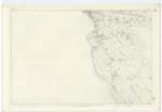
055 | [Situation] On the Wn [Western] Parish Boundary.- A large river passing by the Town of Dumfries from whence it is navigable - it falls into the Solway. |
| KINGHOLM | Kingholm Kingholm Kingholm Kingholm Kingholm |
Ordnance Six Inch Map Mr McLure James Milligan Gazetteer of Scotland Stat: A/c [Statistical Account] of Parish |
055 | [Situation] 5/8 to 1 1/4 Mile S. [South] of St. Michael's Church A low lying portion of Grass land on the east Side of the River Nith, it belonged formerly to the town of Dumfries and was as a place for public Amusements, it is now the property of Mr. Wood, |
Continued entries/extra info
[Page] 200 -- Plan 55.3 -- Trace No. 4 - Parish of DumfriesThis Field is supposed to have received its present name from
King Robert Bruce, in connexion with his having Slaughtered
Comyn- And so to have at one time been called Comyn's- holm
which has been gradually Contracted into Kingholm-
Transcribers who have contributed to this page.
Chr1smac -Moderator
Location information for this page.
Linked mapsheets.