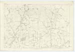
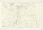
OS1/10/10/64
| List of names as written | Various modes of spelling | Authorities for spelling | Situation | Description remarks |
|---|---|---|---|---|
| LAUDERHOOK | Lauderhook Lauderhook Lauderhook Lodorhook Lodderhook |
James Todd Robert Fergusson Charles Stewart Johnston's Co. [County] map Valuation Rolls |
043 | [Situation] 2 1/4 miles almost East of Lockerbie. A farm house with outb [outbuildings] and Garden Stack yard |
| WATER OF MILK | Milk Water Water of Milk Water of Milk Milke Water Water of Milk Milk Water Milk Water Milk Water Water of Milk |
James Todd Robert Fergusson Charles Stewart Blackwood's Co. [County] Map William Paterson Fullarton's Gazetteer Crawford's Co. [County] map Johnstone's Co. [County] map Statistics of Parish (Old and New) |
043; 051 | [Situation] Partially forming Eastern Parish Boundary. A large River flowin [flowing] in a Southerly direction [direction] through this Plan has its Source in Tundergarth Parish forms the parish By. [Boundary] for about 5 miles, falls into the Annan Wat [Water] |
Continued entries/extra info
[Page] 64Parish of Dryfesdale Plan 43.15 Trace 6
[Signed] Samuel Hill Lc Corpl [Lance Corporal] RS&M [Royal Sappers & Miners]
Transcribers who have contributed to this page.
JCB
Location information for this page.


