OS1/10/5/85


| List of names as written | Various modes of spelling | Authorities for spelling | Situation | Description remarks |
|---|---|---|---|---|
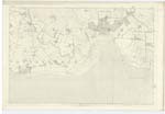
| CAMP (Supposed) [NT Newfield] | Camp (Supposed) Camp (Supposed) Camp (Supposed) |
Robert Boyd Joseph Grierson William Irvine |
061 | [Situation] About 3¾ miles S.E. [South East] from Glencaple. The inhabitants of the district suppose this to have been constructed as a Camp during the days of the Border feuds. In shape it appears to have been rhomboidal, it has a triple entrenchment on the South side; this side appears to been prolonged to Some distance towards the North West as is evident by the existence of a small detached portion in that direction; another detached portion is visible at the same distance from the Camp, but towards the South East, there is also the track of a ditch which possibly may have extended along the Southern face of the work. Doubtless this has been a military work, and from the magnitude of the existing remains, one of importance. The South Western face appears to have been the strongest from which it may be inferred that an enemy was expected to march upon the Camp from that point. |
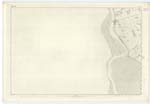
| SOLWAY FIRTH | Solway Firth Solway Firth Solway Firth Solway Firth Solway Firth Solway Frith Solway Frith Solway Frith Solway Frith |
James Hunter Black's Co. [County] Map Lloyds Map of England Ordce. [Ordnance] 6" Map of Kirkcudbright Map in Statistical Acct. [Account] of Dumfries Genl. [General] Roy's Map of Gt. [Great] Britain Walkers Map of Scotland Johnstone's Co. [County] Map Crawford's Co. [County] Map |
060; 061; 065; 066 | A large bay projecting from the Irish Sea Eastward between England and Scotland and washing the Parish of Carlaverock on the south and south-west. It is said to measure 58 miles in length, 37 miles at its entrance and to have a maximum breadth of about 13 miles - it is chiefly remarkable for the peculiar phenomena of its tides -- Ordinary tides rise from 10 to 12 feet spring tides to 20 feet.- |
Continued entries/extra info
[Page] 85Parish of Caerlaverock
Plan 61.10 Trace 2
John Angus Corpl. [Corporal] R S & M. [Royal Sappers & Miners]
Transcribers who have contributed to this page.
ADobie
Location information for this page.