OS1/10/5/70


| List of names as written | Various modes of spelling | Authorities for spelling | Situation | Description remarks |
|---|---|---|---|---|
| LANTONSIDE | Lantonside Lantonside Lantonside Lantonside Lantonside |
Mr. James Crosbie rent receipt Crawford's Co. [County] Map Johnstone's Co. [County] Map Estate Map 1776 |
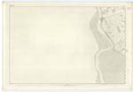
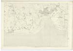
060 | [Situation] About 2 miles S.E. [South East] from Glencaple A neat dwelling house, and buildings garden and farm, Occupied by Mr. James Crosbie, and, is the property of William Constable Maxwell Esq. of Nithsdale |
| CHAPELHILL BURN | Lantonside Burn Lantonside Burn Lantonside Burn Chapelhill Burn Chapelhill Burn |
Mr. James Crosbie Mr. John Scott Mr. James Hunter See Page 45. Plan 61.5 Francis Maxwell Esqr. |
060; 061 | [Situation] From About 2/3 mile S. [South] of Glencaple South to the River Nith. A small shallow rill which takes its rise in the adjoining farm and enters the N.E. [North East] corner of this plan and runs in a S.W. [ South Westerly] direction by Solway Cottage thence across the Shore Road and falls into the sands of the River Nith 18 chains S.E. [South East] of Glenhowan Scar point at which it is lost in the Sands. A continuation of Chapelhill Burn. It rises on the farm of Chapelhill & bears that name throughout its Course, It passes Lantonside farm and that name is applied to it occasionally. The generally recognised Name in locality is Chapelhill Burn |
Continued entries/extra info
[Page] 70Parish of Carlaverock
Plan 60.12 Trace 2
N Donohue May 1856.
Transcribers who have contributed to this page.
ADobie
Location information for this page.