OS1/10/5/66


| List of names as written | Various modes of spelling | Authorities for spelling | Situation | Description remarks |
|---|---|---|---|---|
| SCAR POINT | Glenhowan Scar-point Glenhowan Scar-point Glenhowan Scar-point Scar Point Scar Point |
Mr. James Hunter Mr. John Scott Mr. Thomas Craig Crawford's Co. [County] Map. Johnstone's Co. [County] Map Mr. Maxwell |
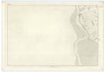
060 | [Situation] Forming S.n. [South Western] point of landward part of Parish, 2 miles S.S.E. [South South East] from Glencaple. A minor projection of land W.ward [Westward] from the Shore Road at Fisher's Bush into the estuary of the mouth of the River Nith, for a distance of About 10 chains. Near the Shore Road it consists of Whins, SInks, Sand, Gravel and Small Stones. the under-lying-shale, consists of basaltic rock sometimes called whinstone in consequence of which it Obtains the name "Scar" And hence is the name by prefix. The name is generally Known in the District and forms a remarkable feature, on the banks of the Nith. |
| SHORE ROAD | Shore Road Shore Road Shore Road |
Mr. James Hunter Mr, John Scott Mr. Thomas Craig |
060 | [Situation] From Sn. [Southern] extremity of Glencaple extending S.S.E. [South South East] and skirting the Parish on W. [West] and S.W. [South West] A local name applied to the Parish Road leading from Glencaple Quay to Bowhouse near Caerlaverock Castle, commands a beautiful prospect of the Estuary of the Nith, the Solway Firth & Cumberland |
Continued entries/extra info
[Page] 66Parish of Carlaverock
Plan 60.12 Trace 2
N. Donahue
Transcribers who have contributed to this page.
ADobie
Location information for this page.
Linked mapsheets.