OS1/10/5/59


| List of names as written | Various modes of spelling | Authorities for spelling | Situation | Description remarks |
|---|---|---|---|---|
| SOLWAY FIRTH | Solway Firth Solway Firth Solway Firth Solway Firth Solway Firth Solway Frith Solway Frith Solway Frith Solway Frith |
James Hunter Black's Co. [County] Maps Lloyd's Map of England Ordce. [Ordnance] 6" Map of Kirkcudbright Map in Statistical Acct. [Account] of Dumfries Genl. [General] Roy's Map of Gt. [Great] Britain Walker's Map of Scotland Johnstone's Co. [County] Map Crawford's Co. [County] Map |
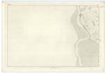
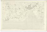
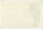
060; 061; 065; 066 | [Situation] Washing Carlaverock Parish on the South A large bay projecting from the Irish Sea Eastward between England and Scotland and washing the Parish of Carlaverock on the south and South-west at which latter point the River Nith forms a long and gradually expanding estuary between Dumfries-shire and Kirkcudbrightshire also Lochar Water at the S.E. [South East] point of Parish, forms a considerable estuary separating Carlaverock from Ruthwell Parish. The Solway Frith is said to measure 58 miles in length, 37 miles at its entrance and to have a maximum breadth of 19 miles and minimum of 8 miles. and a mean breadth of about 13 miles - it is chiefly remarkable for the peculiar phenomena of its tides. - Ordinary tides rise from 10 to 12 feet Spring tides to 20 feet. |
Continued entries/extra info
[Page] 59Parish of Carlaverock
Plan 61.7
Washing Carlaverock Parish on the South
Transcribers who have contributed to this page.
ADobie
Location information for this page.