OS1/10/5/30


| List of names as written | Various modes of spelling | Authorities for spelling | Situation | Description remarks |
|---|---|---|---|---|
| HIGHMAINS CRAIG | Highmains Craig Highmains Craig Highmains Craig |
Robert Nicholson James Forsyth William Irvine |
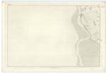
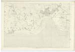
061 | [Situation] 1 mile East from Glencaple. A perpendicular cliff about 100 feet high at the North end of Highmains hill, It is surrounded by a plantation which conceals it from the view of a distant spectator. |
| MOAT [Craig Wood] | Supposed Camp Supposed Camp Supposed Camp Moat. - Moat. - Moat. - |
Robert Nicholson James Forsyth William Irvine. Johnstone's Co. [County] Map Estate Plan 1776 Francis Maxwell Esqr. |
060; 061 | [Situation] In Craig Wood. A single embankment in the form of a crescent, the ends of which abut on a declivity on Highmains hill. This is supposed to have been a camp, by the inhabitants of the locality, and in all probability it may have been so. The South and West sides were protected by an embankment, the remaining sides were protected by a steep declivity formed in part by a perpendicular cliff nearly 100 feet high, no artificial construction was necessary in consequence. The whole is now grown over with fir & beech trees. The embankment is well defined. |
Continued entries/extra info
[Page] 30Parish of Caerlaverock
Plan 61.1 Trace 3
John Angus Corl RSM [Corporal Royal Sappers [&] Miners]
Transcribers who have contributed to this page.
ADobie
Location information for this page.