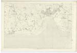
OS1/10/5/28


| List of names as written | Various modes of spelling | Authorities for spelling | Situation | Description remarks |
|---|---|---|---|---|
| BYRES | Byres Byres Byres |
Rev. [Reverend] J.C. Lorraine Mr. James Carruthers. Mr. William Crosbie |
061 | [Situation] Nearly 1 3/4 mile N.E. by East [North East by East] from Glencaple. A low thatched farm house one story high with out offices thatched and in good repair and is the property of William Constable Maxwell Esqr. of Nithsdale |
| LOCHAR WATER | Lochar Water Lochar Water Lochar Water |
Rev. [Reverend] J.C. Lorraine Mr. James Carruthers Mr. William Crosbie |
061 | [Situation] Forming En. [Eastern] Parish Boundary. A large river flowing through Lochar Moss from which it takes its name. [It] falls into the Solway Frith. |
| TOWER (Ruins of) [The Isle] | The Isle The Isle The Isle Isle Tower Tower |
Revd. [Reverend] J.C. Lorraine Mr. James Carruthers Mr. William Crosbie Johnston's Co. [County] Map Francis Maxwell Esqr. |
061 | [Situation] 1 3/4 mile N.E. [North East] from Glencaple. A square building in ruins which has been a place of strength in former times. It has been inclosed on an island and has a drawbridge on the south side.- the walls at pre[sent] stand about 60 feet high with port holes and Tower. The residence of the Maxwell family subsequent to the partial destruction of Carlaverock Castle by the covenanted rebells in 1640. |
Continued entries/extra info
[Page] 28Parish of Carlaverock
Plan 61/1 Trace 2
Transcribers who have contributed to this page.
ADobie
Location information for this page.
Linked mapsheets.