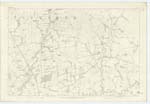
OS1/10/3/55
| List of names as written | Various modes of spelling | Authorities for spelling | Situation | Description remarks |
|---|---|---|---|---|
| HIGHLAW | Highlaw | William Dickson Sibblebieside Peter Glover Netherhall William Jardine Uppercleugh |
043 | [Situation] Nearly 1 mile N.E. [North East from Netherhall A pretty high hill, covered with good arable ground, from the summit of which may be obtained a comprehensive view of the surrounding district for many miles. Is situated immediately behind Sibblebieside farm house, and is a part of that ridge, or hill range, which stretches along on the west side and nearly parallel to Dryfe Water. |
| CRAIGHEAD HILL | Craighead Hill | William Dickson Sibblebieside Peter Glover Netherhall William Jardine Uppercleugh |
043 | [Situation] 1 mile NE by N [North East by North] from Netherhall. A prominent portion of arable ground which lies at the N. [North] West and is a branch of Highlaw Hill. It likewise stands at the head of a steep brae, partly covered with projecting rocks or craigs, hence the name Craighead. |
Continued entries/extra info
[Page] 55Parish of Applegarth Sheet 43.1 trace 1
[Signed] John Jane Sapper R.E. [Royal Engineers]
Transcribers who have contributed to this page.
DANIALSAN, E Henderson
Location information for this page.
Linked mapsheets.


