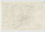
OS1/10/3/40
| List of names as written | Various modes of spelling | Authorities for spelling | Situation | Description remarks |
|---|---|---|---|---|
| BLINDHILLBUSH | Blindhillbush Blindhillbush |
John S. Graham of Shaw Val. [Valuation] Roll 1856 James Bryden Shepherd C. Stewart Esqr. |
034 | [Situation] 65 chains N.E.E. [North East East] from Newbigging A farm house with Offices etc attached occupd. [Occupied] by John S. Graham of Shaw - the property of J. J. H. Johnstone Esqr. |
| BLINDHILLBUSH BURN | Lake Burn Lake Burn Blindhillbush Burn |
John Graham Farmer James Bryden Shepherd C. Stewart Esqr. J. Graham, Shaw G. Graham, Shaw J. Wright, Boreland |
034 | [Situation] On En. [Eastern] Parish Boundary. A small stream running past the N. [North] side of Blindhillbush forming the boundary of the Parishes of Applegarth & Hutton & Corrie & falls into Dryfe Water. |
| FORT [Blindhillbush Hill] | British Fort | David Halliday (Carpenter Blindhillbush) David Little J. Bryden C. Stewart Esqr. |
034 | [Situation] On Blindhillbush Hill. Remains of a "Camp" or "Fort", Situated on the Summit of Blindhillbush Hill. It is in tolerable good preservation and supposed to be of ancient british origin. J.W. |
Continued entries/extra info
[Page] 40Ph. [Parish] of Applegarth Sheet 34 No. 14 Trace 2 & 1
J. Nish
c/a [civilian assistant]
Transcribers who have contributed to this page.
DANIALSAN, mikeh, E Henderson
Location information for this page.
Linked mapsheets.


