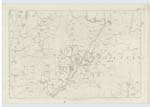
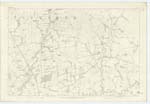
OS1/10/3/103


| List of names as written | Various modes of spelling | Authorities for spelling | Situation | Description remarks |
|---|---|---|---|---|
| DRYFE WATER | Dryfe Water Dryfe Water Dryfe Water Dryfe Water Dryfe Water |
John Davidson Manufacturer Joseph Graham Farmer Thomas Graham Gentleman Statl. Acct. [Statistical Account] of Parish Webster's Topographical Dictiony [Dictionary] Fullarton's Gazetteer |
034; 043 | [Situation] From Hutton & Corrie Parish S.W by S. [South West by South] on to Sn [Southern] Parish Boundary. A small river rising at Lochfell at the northern extremity of the Parish of Hutton, its width does not exceed half a chain and throughout it is Very shallow after a S. [South] westerly course of about 15 Miles it falls into the River Annan About a mile below Applegarth Kirk |
| FREEDOM DEEP | Freedom Deep Freedom Deep Freedom Deep |
Mr. Robert Carruthers farmer of Lammonbie Mr Jardine farmer Mr. Thomas Carruthers. |
043 | [Situation] In Dryfe Water. A pool in Dryfe Water and applies to the stream for a distance of 7 chs [chains] |
Continued entries/extra info
[Page] 103Parish of Applegarth Plan 43/5 Trace 6
Transcribers who have contributed to this page.
DANIALSAN, cpm
Location information for this page.