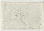
OS1/7/13/1
| List of names as written | Various modes of spelling | Authorities for spelling | Situation | Description remarks |
|---|---|---|---|---|
| WICK [parish] | Wick Wick Wick Wick Wick Wick Wick Wick |
New Statistical Account BlacK's Map of Scotland Oliver & Boyd's Almanac Census Returns for 1871 published in the Daily Scotsman Newspaper 19th April 1871 Valuation Roll 1871 & 72 James Brims Procr [Procurator] Fiscal, Thurso William Miller Esq Town ClerK Grainger & Miller's Map of Caithness |
013 | The Parish of WicK is in the presbytery of Caithness, and Synod of Sutherland & Caithness, Patron Sir G Dunbar Bt. [Baronet] of AcKergill; its is bounded on the north by the parish of Canisbay, on the south by the parish of Latheron, on the West by the parishes of Bower & Watten and on the east by the Moray Firth. The greatest length of the parish from north to south is about 16 miles and its greatest breadth from east to west is about 7 1/2 miles; it contains about 48625 statute acres. There are no detached portions of the parish of WicK, nor are there any detached portions of any other parishes situated within it. " The surface of the parish is in general flat, or but very gently sloping in different directions. The northern parts generally face the south, and the southern have a northern & north-eastern exposure as shewn by the run of the water, Its aspect is bleaK unpicturesque, and tame. The heights of Yarrow & Camster, towards the south-west of the parish, are the only hills deserving the name. Their elevation above the sea is considerable, but their appearance is dull & heavy". (New Stat Acct [New Statistical Account] The town of WicK is situated on the Moray Firth about half way between the extreme northern & southern limits of the parish, besides the town the parish contains the important fishing villages Staxigoe, Keiss, & Sarclet. |
Continued entries/extra info
[Page] 1Transcribers who have contributed to this page.
Moira L- Moderator, Nora Edwards, Dirtywicker
Location information for this page.
Linked mapsheets.


