OS1/6/5/26


| List of names as written | Various modes of spelling | Authorities for spelling | Situation | Description remarks |
|---|---|---|---|---|
| ARDMALEISH | Ardmaleish Ardmaleish Ardmaleish Ardmaleish Ardmaliesh Ardmalish Ardmaleish |
Val [Valuation] Roll Estate Map Wilson's Guide to Bute Mr. Muir Factor Johnstone's Coy. [County] Map County Directory Origines Parochiales |
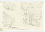
194.10 | A large farm steading the property of the Marquis of Bute A little to the north of the farm steading is a large standing stone, which the Revd. [Reverend] Mr. McBride believes to be a "monumental stone" |
| STANDING STONE [Ardmaleish] | 194.10 | A little to the north of the farm steading [of Ardmaleish] is a large standing stone, which the Revd. [Reverend] Mr. McBride believes to be a "monumental stone" | ||
| DOVE'S CRAIG | Doves Craig Doves Craig Doves Craig |
Estate Map Mr. Muir Factor John Crawford Kamesburgh |
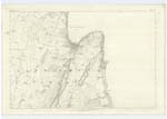
194.10 | A small rocky Knowe, near the sea shore and to the East of Ardmaleish farm steading. |
| UNDRAYNIAN POINT | Undraynian Point Undraynian Point Undraynian Point |
Estate Map Mr. Muir Factor John Crawford Kamesburgh |
194.10 | A point of land forming the northern limit of Kames Bay. |
| FIRTH OF CLYDE | Firth of Clyde Firth of Clyde Firth of Clyde |
Admiralty Chart Johnstones Coy. [County] Map Topographical Works of Reference |
194; 204 | This name applies to the Eastern side of the Island of Bute commencing at Ardmaleish on the NE. [North East] to Garroch Head on the South. |
Continued entries/extra info
[Page] 26County of Bute -- Parish of North Bute
Transcribers who have contributed to this page.
Alison James- Moderator, JCB
Location information for this page.