OS1/5/40/8


| List of names as written | Various modes of spelling | Authorities for spelling | Situation | Description remarks |
|---|---|---|---|---|
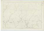
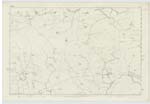
| LAMMERMOOR HILLS | Lammermoor Hills | County Map New Statistical Account of Berwickshire Fullerton's Gazetteer |
014 ; 015 | A broad range of Moorish heights Stretching eastward from the Vale of Gala Water, in the S. [South] East extremity of MidLothian, to the German Ocean, at the promontories of St. Abbs Head. Earncleugh & Fast Castle in the parish of Coldingham Berwickshire The Lammermoors, are, in themselves, an extensive Curvature of, for the most part, wild, cheerless, unsightly heights, - nowhere bold & imposing in aspect, and after Subsiding into low rolling table-lands. of bleak Moor - They were at one time clothed with Forest, & must then have been as bewildering to the Traveller, as grandly Sylvan in their vast contribution to the landscape. They still have natural woods hanging on Some of their Steeps, and, in Such localities, are warmed out of their chilliness of aspect -; but over their Summits, & down their higher Slopes, they are almost everywhere nakedly dressed in heath. Lammer Law, with rises in the parish of Lauder and gives name to the whole range has an altitude of 1500 feet - Among other chief or remarkable Summits, according of Blackadder in his Survey of Berwickshire, Criblaw has an elevation of 1615 feet; Clinthill 1544; Tippet Knowes 1323; Manslaughter Law, 1273; Twinlaw Hill, 1260; Earlston Hill 1200; Great Dirrington Law, 1145; Ayrhousehill 1054; Bemersidehill, 1011; & Cockburnlaw 912 feet. |
Continued entries/extra info
[page] 8Parish of Westruther -- W Beatty
Transcribers who have contributed to this page.
Moira L- Moderator, GreenflyNZ
Location information for this page.