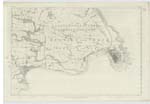
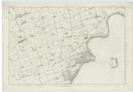
OS1/5/25/3
| List of names as written | Various modes of spelling | Authorities for spelling | Situation | Description remarks |
|---|---|---|---|---|
| RIVER TWEED | River Tweed | Map of Scotland Map of Berwickshire Fullerton's Gazetteer of Scotland |
018 ; 023 | The Tweed has its source in a paltry fountain called "Tweed's Well" a little above the farmhouse of "Tweed'shaws" and at the foot of a hill named "Tweed's cross". an the southwest boundary of the Parish of Tweedsmuir. Peebleshire, The well is half a mile from Lanarkshire on the west, the same distance from Dumfriesshire an the south, And 1500 feet above the level of the Sea. From other sides of the hill where it springs up, proceed rills to the gathering or incipient volumes of the Clyde and the Annan, yet not such as can with any justice be pronounced more than secondary head streams of these rivers. Over 22 miles from its source the Tweed runs prevailingly northeastward, and over the remaining 14 miles of the Peeblesshire part of its course in the direction of east by South. During its connexion with Selkirkshire it continues as in the latter part of its course in Peeblesshire, to run prevailingly eastward. till the last 9 or 10 miles, and over these it runs in the direction of North-east by east. In a small part of this ran it divides Selkirkshire from Roxburghshire and in two places it divides Roxburghshire from Berwickshire. After leaving Roxburghshire the Tweed is but partially a Scottish river it divides Berwickshire from England till |
Continued entries/extra info
Parish of Hutton -- [page] 3Situation -- on Sheets -- 23.4 -- 24.1 -- 18.13 -- 18.9 and 18.10
Transcribers who have contributed to this page.
Christine Y
Location information for this page.


