OS1/3/51/1/61


| List of names as written | Various modes of spelling | Authorities for spelling | Situation | Description remarks |
|---|---|---|---|---|
| BURNOCK | Burnock Burnock . Burnock Burnock Burnock W. [Water] . Burnock Water |
Quintin Stewart W. Montgomery Walker Thomas Cuthbert William Paterson Johnston's County Map Statistical Account |
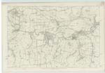
035 ; 041 | A stream formed by the junction of the Black Water and Blue Boots Lane, about ¼ mile north of BurnocKhead, falling into the Lugar at the village of Ochiltree. It is rapid, and has, in many parts steep banks, and in general a gravelly bed. |
| AUCHINCLOIGH CASTLE (Ruins of) | Auchencloigh Castle Ruins "ruins of an old castle at Auchincloich" |
Johnston's County Map Statistical Account (1842) |
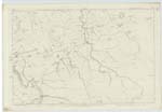
040 | All that now remains of this is a broken and irregular mass of stone & lime. To all appearances it has once been a quadrangular building, as the remaining portions of the walls indicate, which are from 2 to 5 feet high and about 5 feet in thickness. It stands in close proximity to Auchencloigh and a small portion of it has been converted into and is used as a sheep - ree. - To judge from the huge fragments which now remain it must have been a place of great strength, but there is no person in the neighbourhood can give any information as to when, or for what purpose it was erected and though it is known by some as Auchencloigh Castle, by others it is asserted as having been nothing more than a farmsteading. |
Continued entries/extra info
[Page] 61Sheets 35.3.9.13 - 41.1 & 5 Parish of Ochiltree
"The ruins of a
house still exist
contiguous to
Auchencloigh"
Examination Trace and
c/a [Civilian Assistant] Park Examiner
Transcribers who have contributed to this page.
Chr1smac -Moderator, hillhere
Location information for this page.