OS1/3/51/1/36


| List of names as written | Various modes of spelling | Authorities for spelling | Situation | Description remarks |
|---|---|---|---|---|
| GARROCHHILL | Garroch-hill Garrochill Garrochill Garrochill Garrochill Garrochill Garrochill |
Rev. [Reverend] A. Duncan John Smith, Schoolmaster W. A Logan David Campbell Esqr. Robert Kirkland Teacher Johnston's County Map County voters list |
034 | Farm Steading consisting of dwelling house and out offices the former two Storey & slated the latter one Storey and thatched all in good repair Property of William Logan Joppa. Alexander Logan Joppa |
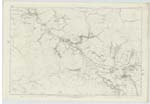
| SHAW CHURCH | Shaw Church or Stair Free Church Shaw Church or Stair Free Church Shaw Church or Stair Free Church Shaw Church or Stair Free Church Shaw Free Church |
Rev. [Reverend] A Duncan Mr John Smith . Alexander Logan . Robert Kirkland Teacher County voters list |
034 | Erected in the year 1851 by private Subscription. In the plain modern Style of architecture. Is the Second Free Church in the Ph. [Parish]. Sittings 200 - [300] |
| STAIR FREE CHURCH | Shaw Church or Stair Free Church Shaw Church or Stair Free Church Shaw Church or Stair Free Church Shaw Church or Stair Free Church Shaw Free Church |
Rev. [Reverend] A Duncan Mr John Smith . Mr Logan . Robert Kirkland Teacher County voters list |
034 | Erected in the year 1851 by private Subscription. In the plain modern Style of architecture - Is the Second Free Church in the Ph. [Parish] - Sittings 200 - [300] |
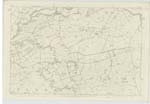
| WATER OF COYLE | Water of Coil . Water of Kyle Water of Coyle or Coil Water of Coil Water of Coil . Water of Coil . Water of Coil Water of Coyle |
Rev. [Reverend] Alexander Duncan Mr John Smith David Campbell . Robert Kirkland John [Joseph] Burnett Esq James Miller & John Campbell John McCartney & James Thorn Authorities for Dalmellington Parish |
034 ; 046 | A well Known Stream which rises from Surface water in the east base of Benwhat South of Dalmellington. It has a winding Course of about 10 miles in a north westerly direction, falling into the River Ayr adjacent to Sundrum 4 miles from Ayr. It forms the boundary between the Parishes of Coylton and Ochiltree and Coylton & Stair. Its Course is for the most part through an agricultural Country, on a gravelly bed. Its banks, in many places, are precipitous and in general well wooded. |
Continued entries/extra info
[Page] 36Sheet 34, 10 - Parish of Ochiltree
Transcribers who have contributed to this page.
Chr1smac -Moderator, hillhere
Location information for this page.