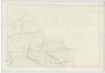
OS1/3/48/41


| List of names as written | Various modes of spelling | Authorities for spelling | Situation | Description remarks |
|---|---|---|---|---|
| WATERHEAD | Waterhead Waterhead Waterhead Waterhead Waterhead |
Valuation Roll. Muirkirk Voters-list. Muirkirk John Maider. Occupier Voters List - County Map - |
026 | A farm house having offices and ground &c. attached. The property of T. Anderson. Esqr. |
| BROWN HILL | Brown Hill Brown Hill Brown Hill |
Estate Map. Tordoors J. Allison. Proprietor [pt] John Maider. Waterhead |
026 | An elevated portion of ground covered with pasture. Extent defd [defined] on Examination Trace, |
| PONESK BURN | Ponesk Burn Ponesk Burn Ponesk Burn Powness Water |
Estate Map. Muirkirk Mr. J. Whyte. facr [factor] Muirkirk James Ferguson. "Priesthills" Co [County] Map - |
026 | A stream rising on the farm of Priesthills, flows in a South-Westerly direction to "Cleugh Head", thence in a Southerly direction to its junction with the "Water of Ayr". |
Continued entries/extra info
[Page] 41County of Ayr -- Parish of Muirkirk
Transcribers who have contributed to this page.
Chr1smac -Moderator, George Howat
Location information for this page.
Linked mapsheets.