OS1/3/46/41


| List of names as written | Various modes of spelling | Authorities for spelling | Situation | Description remarks |
|---|---|---|---|---|
| KIRKBRIDE (Ruins of) | Kilbride Kirkbride |
W. Menzies J. G. Hannay W Rennie William Brown Johnston's County Maps |
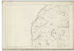
038 | The remains of an old Church or Chapel on the farm of Dunduff, with a Burying pound attached and Still used. There is a Small portion of the walls standing about ten feet high but the Greater part of it is nearly level with the ground. No information Can be obtained when it was erected or whether it may have been a Parish Church, but it is very probable it has been a 'Chapel of Ease' in connection with the Collegiate Church of Maybole. |
Continued entries/extra info
Parish of Maybole - - [Page] 41"The ruins of several religious houses are still to be traced in
"different parts of the parish. The walls if the church of Kirkbride
"on the farm of Dunduff are distinct, the surrounding burying ground
" is still used, and an adjoining field bears the name of the Priest's
" Land. At Auchendrane and elsewhere, the number of similar erections
" were visible when Abercrombie wrote his Journal. Kirkbride has generally
" been considered as a parish united to Maybole, but being unable to
"find any notice of the union, I am rather inclined to think that
" it and the other ruins refer to the chapels attached to the
"Collegiate Church of Maybole." - Statistical Account (1842).
"Even the church of Kirkbride seems to have existed previously
"at all events contemporaneously with that of Maybole, both of which
"were granted by Earl Duncan to the Cistertian monnery of North Berwick
"the latter in 1216. This grant was confirmed by Neil, the son of
" Duncan of Carrick *** The Parish of Kirkbride, which was
"dedicated to St. Brigide, also continued in the hands of the Nuns
"of North Berwick till the Reformation. It stood on the
" sea-coast.
Transcribers who have contributed to this page.
Chr1smac -Moderator, graham rolph
Location information for this page.
Linked mapsheets.