OS1/3/42/157


| List of names as written | Various modes of spelling | Authorities for spelling | Situation | Description remarks |
|---|---|---|---|---|
| HILL OF STAKE | Hill of Stake Hill of Stake Hill of Stake Hill of Stake Hill of Staik Hill of Stake Hill of Stake |
John Boyd Esq Largs James Crawford Esq Hemplaw Mr. Robert Beith Largs Aiken's Map of Parish New Stat. Acct. [Statistical Account] New Stat. Acct. [Statistical AccouNew Stat. Acct. Full. [Fullarton's] Gazetteer |
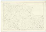
004 | A Hill of considerable altitude in the Moors north east of Largs. There is a Trigl [Trigonometrical] Station on its summit where the Parishes of Largs Lochwinnoch & Kilbirnie meet. A very extensive tract of Country is seen from the Trigt Statn [Trigonometry Station] Pole. |
| WEST GIRT HILL | West Girt Hill West Girt Hill West Girt Hill |
John Boyd Esq James Crawford Esq Mr. Robert Beith |
004 | An extensive heathy covered eminence near Hill of Stake. The Parish boundary passes over it |
| LONG HILL | Long Hill Long Hill Long Hill |
Mr. Robert Beith Mr. Malcolm Cochrane Blairpark James Crawford Esq |
A Hill about ½ a mile South and west from West Girt Hill. The Parish boundary passes over or along its summit. | |
| Waterhead Moor | See page 61 DH | see name sheets for 2.13 | ||
| Greeto Water | See page 152 DH | See name sheets of 6.1 |
Continued entries/extra info
[Page] 157Transcribers who have contributed to this page.
DANIALSAN, CRIMSON
Location information for this page.
Linked mapsheets.