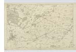
OS1/3/36/30


| List of names as written | Various modes of spelling | Authorities for spelling | Situation | Description remarks |
|---|---|---|---|---|
| NETHER CRAIG | Nether Craig Nether Craig N. [North] Craig |
William P. Morris John Highet Farmer Johnston's Map of Ayrshire |
017 | [Situation] 213 Chains S.W. [South West] of Kilmaurs. Farm House with Offices and farm of land attached [occupied] by John Highet and the [property] of W. P. Morris |
| MILTON MILL | Milton Mill Milton Mill Miltown Milnton Miln or Mill |
William P. Morris Robert Brown, Tenant Johnston's Map of Ayrshire Co [County] Voter's List |
017 | [Situation] 240 Chains SW [South West] of Kilmaurs. A Corn Mill wrought by water power occupied by Robert Brown the property of W. P. [Morris] |
| HOLMES | Holmes Holmes Holmes |
Archibald Cunningham James Smith Johnston's Map of Ayrshire |
017 | [Situation] Plan 17.16. 184 Chains SWW [South West by West] of Kilmaurs. Farm House with Offices & a farm of land attached [occupied by] James Smith & the property of Archibald Cunningham |
| THORNTON ROW | Thornton Row | Archibald Finnie | 017 | [Situation] 188 Ch. [Chains] S.W. [South West] [of Kilmaurs] A range of small Cottages occupied by Colliers occupied by Colliers |
| LAURIELAND | Laurieland Laurieslaw |
Archibald Cunningham Johnston's Map of Ayrshire |
017 | [Situation] 176 Chains SW [South West] of Kilmaurs. Cottage & Garden occupied by A. Dale & the property of A. [Cunningham] |
| LAURIELAND ROW | Laurieland Row | Archibald Cunningham | 017 | [Situation[ 174 Chains SW [South West] of Kilmaurs. A range of small Cottages occupied by Colliers |
Continued entries/extra info
[Page] 30Parish of Kilmaurs -- Co [County] Ayr -- Plans 17.15 & 16 [?]
Plan Correct [above name "Holmes"]
Transcribers who have contributed to this page.
Chr1smac -Moderator, JCB
Location information for this page.
Linked mapsheets.