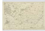
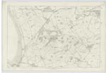
OS1/3/36/29


| List of names as written | Various modes of spelling | Authorities for spelling | Situation | Description remarks |
|---|---|---|---|---|
| HALLBARNS | Hall Barns Hallbarns Hallbarns |
Hugh Stevenson Farmer Johnstons Map of Ayrshire List Co [County] Voters |
017 | [Situation] 231 Chains S.W. [South West] of Kilmaurs. Farm House and Offices with a farm of land attached occupied by H. Stevenson and the property of the Heirs of P. Warner |
| TODHOLES | Todholes Todholes |
W. P. Morris Johnston's Map of Ayrshire |
017 | [Situation] 257 Chains S.W. [South West] of Kilmaurs. Cottages & Gardens occupied by James Burns & others & the property of W. P. Morris |
| NEWHOUSE | New House New House Newhouse Newhouse |
William P Morris John Smith Farmer Johnston's Map of Ayrshire Co [County] Voters List |
017 | [Situation] 267 Chains S.W. [South West] of Kilmaurs. Farm House with Offices and a farm of land attached occupied by John Smith & the property of W. P. Morris |
| CRAIG | Craig Craig Craig |
W. P. Morris Johnston's Map of Ayrshire Peterson's Hist. [History] Ayrshire |
017 | [Situation] 255 Chains S.W. [South West] of Kilmaurs. A Mansion House with Offices, Garden & Ornamental grounds the residence and property of W. P. Morris |
| RIVER IRVINE | River Irvine | Topographical & Statistical Works | 017 ; 022 | [Situation] Tracing Southern Parish Boundary and a portion of Eastern on this Plan. A River having its Source near Drumclog tracing for the most part S. [South] Parish Boundary and a Small portion of the East. It separates the districts of Kyle and Cunningham and falls into the Firth of Clyde. |
Continued entries/extra info
[Page] 29Parish of Kilmaurs -- Co [County] Ayr -- Plan 17.15
Plan Correct [Name "Hallbarns"]
Transcribers who have contributed to this page.
Chr1smac -Moderator, JCB
Location information for this page.