OS1/3/22/61


| List of names as written | Various modes of spelling | Authorities for spelling | Situation | Description remarks |
|---|---|---|---|---|
| KILMEIN HILL | Kilmein Hill Kilmein Hill Kilmein Hill Kilmein Hill Kilmein Rigg |
A Hervey N. Gilchrist N. G. Galloway Johnston's County Map |
040 | A prominent sheep pasture hill on the Summit of which is a Trig [Trigonometrical] Station. It commands a grand view - The Old Roman Road (as Supposed) passed by west foot along the old road from Ayr to Dalmellington into Galloway - The property of A Oswald Esqr & Col [Colonel] Cathcart There is a stone fence running over the East side of this hill which divides the parishes of Dalrymple and Coylton |
| KILMEIN (Ruin) | Kilmein Kilmein Kilmein Kilmein |
A Hervey N. Gilchrist N. G. Galloway |
040 | The Ruin of a Farm Steading the walls of which at present are 5 feet high. The property of A. Oswald Esqr |
| KILMEIN MOUNT | Kilmein Mount Kilmein Mount Kilmein Mount Kilmein Mount |
A. Hervey N. Gilchrist N. G. Galloway |
040 | A small but prominent knoll adjacent to Kilmein old Farm Steading it is Rocky and a little Steep on all sides the rocks are basaltic and conspicuous The property of A. Oswald Esqr |
Continued entries/extra info
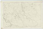
[Page] 61Dalrymple Parish -- Sheet 43 Plan 3 also Sheet 40 Plan 15
Transcribers who have contributed to this page.
Trondragirl- Moderator, ADobie
Location information for this page.
Linked mapsheets.