OS1/3/21/92


| List of names as written | Various modes of spelling | Authorities for spelling | Situation | Description remarks |
|---|---|---|---|---|
| CLAWFIN | Claffin Clawfin Clawfin. Clawfin Clafin |
- A. Hervey W. Gilchrist W. G. Galloway Johnston's County Map |
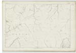
047 | A large Farm Steading one Storey high partly Slated and partly Thatched in good repair on the South of Turnpike road from Dalmellington to New Cumnock there is a large extent of moorland and Some arable attached to this farm the property of the Hone. [Honourable] Colonel F. M. Cathcart |
| RED CLEUGH BURN | Red Cleugh Burn Red Cleugh Burn Red Cleugh Burn Red Cleugh Burn |
- A. Hervey W. Gilchrist W. G. Galloway |
047 | A Small Stream collecting and flowing in a northerly direction from the north east Side of Camlarg Hill till it forms the Cummock Burn at where the Black Burn falls into it. - |
| WHITE BURN | White Burn White Burn White Burn White Burn |
- A. Hervey W. Gilchrist W. G. Galloway |
047 | A Small but rapid Stream flowing in a northerly direction down a Steep part of Camlarg hill and collecting on the Summit of it it joins the Cummock Water east of Little Camlarg. - |
Continued entries/extra info
[Page] 92Parish of Dalmellington Sheet 47 - 9
[Note]
Altered by directions
from O.M.O [Ordnance Map Office]- "c" having
been decided to be used
instead of "g", on the Scotch
plans, in this word. J.L.
Transcribers who have contributed to this page.
Chr1smac -Moderator, hillhere
Location information for this page.
Linked mapsheets.