OS1/3/21/56


| List of names as written | Various modes of spelling | Authorities for spelling | Situation | Description remarks |
|---|---|---|---|---|
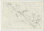
| CUMMOCK BURN | Cummock Burn Cummock Burn Cummock Burn Cummock Burn Cummock Burn |
- A. Hervey W. Gilchrist W. G. Galloway Johnston's County Map |
046 ; 047 | A rapid mountain Stream commencing at the junction of a small, nameless stream with Linn Water; its general course is along Side of the Turnpike road to Cumnock passing Camlarg till it joins the Water of Muck at Smith's Bridge, west of the village of Dalmellington; after passing [--] its course is more artificial than not its spaned by five Stone Bridges viz Buchans, Sillyhole, new Railway one, and [two] nameless ones. viz the one over the Dalmellington and Cumnock Turnpike road (which [is a] good Substantial Freestone Bridge) [and] the other on an old road east of Camlarg formerly the old road to Cumnock from its Source to Camlarg its course is [--] and on Some Sides Cliffy especially [--] Camlarg, all along its Sides can be [seen] Coal mines protruding. |
Continued entries/extra info
[Page] 56Parish of Dalmellington -- Sheet 46 -12 and 47 - 5. 6. 10 & 9
Note.
Captn. [Captain] Bayly's Examiners have supplied
the name "Linn Water" for a portion of this
stream. The difference has been enquired
into, and "Linn Water" found to be the proper
name, as far as the stream forms the boundary
between the Ph. [Parish] of Dalmellington and New Cumnock,
From thence, the name of the stream is
Cummock Burn.
Transcribers who have contributed to this page.
Chr1smac -Moderator, hillhere
Location information for this page.