OS1/3/21/21


| List of names as written | Various modes of spelling | Authorities for spelling | Situation | Description remarks |
|---|---|---|---|---|
| BLACK WATER | Black Water Black Water Black Water Black Water Black Water |
Estate Map 1844 A. Hervey W. Gilchrist W. G. Galloway Johnston's County Map |
046 | A Stream collecting in a deep broken Surface moss, north of Benbraniachan flowing in an easterly direction as far as the north margin of the Parish It forms the Parish Boundary for nearly the whole of its course between Ochiltree and Dalmellington and after leaving the latter is the Boundary between the former and New Cumnock, after leaving this Parish it becomes a larger rapid Stream, the name is quite Descriptive it is both Black and dirty, on each Side of its banks are large extents of deep broken Surface moss Scarcely producing a blade of grass. |
| CHALMERSTON HILL | Chalmerston Hill Chalmerston Hill Chalmerston Hill Chalmerston Hill |
- A. Hervey W. Gilchrist W. G. Galloway |
046 | A Small hill in extent but rather prominent connected with Benbeoch as forming the Same ridge, it affords good pasture for Sheep. its Surface is partly covered with Scattered rocks the property of the Hone. [Honourable] F M Cathcart Berbeth |
Continued entries/extra info
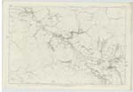
[Page] 21Dalmellington Parish Sheet -- 46 Plan 4 and Sheet 47 Plan 1
Transcribers who have contributed to this page.
Chr1smac -Moderator, hillhere
Location information for this page.
Linked mapsheets.