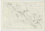
OS1/3/21/17


| List of names as written | Various modes of spelling | Authorities for spelling | Situation | Description remarks |
|---|---|---|---|---|
| BENWHAT [hill] | Benwhat Benwhat Benwhat Benwhat Benwhat |
Estate Map 1844 A. Hervey W. Gilchrist W. G. Galloway Johnston's County Map |
046 | A prominent high rocky hill, on the top of which is a Trig [Trigonometrical] Station, - the most westerly on a nameless ridge extending from Patna to terminate in Benbain along the north margin of the Parish - It rises abrupt on the South and east Sides, Slopes gradually on the Others, it affords good pasturage for Sheep, the Rocks on it are basaltic and in Some places appear prominent at a distance the property of the Hone. [Honourable] F. M. Cathcart |
| CRAIGDONKEY | Craigdonkey Craigdonkey Craigdonachy Craigdonkey Craigdonkey |
- A. Hervey W. Gilchrist W. G. Galloway R Smith |
046 | A Small rocky cliff on the north margin of Benwhat and adjacent to the Parish Boundary, its rock and all those around Benwhat are Basaltic |
Continued entries/extra info
[Page] 17Parish of Dalmellington -- Sheet 46 Plan 3
Transcribers who have contributed to this page.
Chr1smac -Moderator, hillhere
Location information for this page.
Linked mapsheets.