OS1/3/21/14


| List of names as written | Various modes of spelling | Authorities for spelling | Situation | Description remarks |
|---|---|---|---|---|
| CORBIE CRAIGS | Corbie Craigs Corbie Craigs Corbie Craigs Corbie Craigs |
Estate Map 1844 A Hervey W. Gilchrist W. G. Galloway |
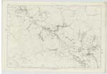
046 | A Deep Ravine or Gorge extending in a northerly direction from its head of Dunaskin Glen along on both Sides of Burnhead Burn, Some places its Sides are grassy Sloping gradually but Steep, other places its Sides are nearly 80 feet of a perpendicular height with large Shapeless rocks projecting and overhanging of a volcanic nature. The deepest part of it is the narrowest Scarcely admitting the Stream at the bottom to flow through and on which at this place there is a grand waterfall of about 20 feet, here indeed the Corbies might Safely build without the fear of being molested by any human being. North and South of this narrowest part it becomes less Conspicuous Rocky and Cliffy. Though the whole of the Ravine is now called Corbie Craigs I should think that the name was only applicable to the place where the Corbies built their nests in old times. The property of Hone. [Honourable] Cathcart |
| BURNHEAD BURN | Burnhead Burn Burnhead Burn Burnhead Burn Burnhead Burn |
- A Hervey W. Gilchrist W. G. Galloway |
046 | A Stream collecting and flowing from north Side of Benwhat in a westerly direction forming the Parish Boundary between Dalmellington & Coylton thence flowing in a Southerly direction through Corbie Craigs till it joins Dunaskin Burn at the head of Dunaskin Glen |
Continued entries/extra info
[Page] 14Parish of Dalmellington -- Sheet 46 Plan 7
Transcribers who have contributed to this page.
Chr1smac -Moderator, KimHarsley-ProjectOfficer, hillhere
Location information for this page.
Linked mapsheets.