OS1/3/15/57


| List of names as written | Various modes of spelling | Authorities for spelling | Situation | Description remarks |
|---|---|---|---|---|
| PULGANNY BURN | Pilgannie Burn Pilgannie Burn Pilgannie Burn Pulganny Burn |
William McCrie John Jamieson John F. Gray 6 Inch engraved sheet, N. 2, of Wigtonshire. |
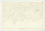
071 | [Situation] Enters the plan near the S. W. [South West] Corner & flows in a Northeasterly direction, Emptying itself into Lochmaberry" A rapid mountain stream, rising in the moors of Wigtonshire, and empties itself, into Lochmaberry; a considerable portion of which forms the boundary between the Counties of Wigton, and Ayr. |
| KNOCKEYCAW | Knockeycaw Knockeycaw Knockeycaw |
William McCulloch William McCrie John Jamieson |
071 | [Situation] Situated near the Centre of the plan A prominent Heathy pasture hill, with a Trig [Trigonometrical] Station on its summit The Property of the Trustees, of the late Sir William Fettes. |
Continued entries/extra info
Sheet 71 Plan 12 Traces 1,2,3,4 & 5 -- Parish of Colmonell -- [Page] 57"This word is Celtic & Seems to signify the Hill of Battle;
cnoc pronounced Knoc being gaelic
for Hill & cath, pronounced cah a battle or
Skirmish. It is probable that at some remote period
this place was the scene of a battle or some feudal broil, the battle being no
uncommon sight in Scotland previous to the suppression of the System (Feudal System [W ] McRae)
Transcribers who have contributed to this page.
Chr1smac -Moderator, macfam
Location information for this page.
Linked mapsheets.