OS1/3/15/45


| List of names as written | Various modes of spelling | Authorities for spelling | Situation | Description remarks |
|---|---|---|---|---|
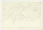
| CHIRMORIE CAIRN | Chirmory Cairn Chirmorie Cairn Chirmorie Cairn Chirmorie Cairn Chirmorie Cairn Chirmory Cairn |
Estate Map 1772 James McIlraith Esqr Revd [Reverend] William Dill Revd [Reverend] William Moore William McCulloch Esqr Johnstons Co. [County] Map. |
071 | A very prominent Rocky pasture hill, About 800 feet above the level of the sea. It is of a conical shape, but there has never been a cairn on it, only a small heap of stones stood where the Trig [Trigonometrical] Station now is: The property of The Trustees of the late Sir W Fettes |
Continued entries/extra info
Sheet 71 Plan 9 Trace 2 -- Parish of Colmonell -- [Page] 45Transcribers who have contributed to this page.
Chr1smac -Moderator, macfam
Location information for this page.
Linked mapsheets.