OS1/3/15/12


| List of names as written | Various modes of spelling | Authorities for spelling | Situation | Description remarks |
|---|---|---|---|---|
| LAGGISH | Laggish Laggish Laggish Laggish Laggish |
Thomas Scott William Dill John Jamieson James McIlwraith Johnstons Co. [County] Map. |
071 | [Situation] In the South eastern section of the plan, 150 chains N.E. [North East] by E [East] of Chirmorie Cairn. A farm house with out offices, built of lime and Stone, one Story high and in good repair. Situated about one mile east of the Barrhill and Glen Luce road and four miles from the latter place. |
| LAGGISH BURN | Laggish Burn Laggish Burn Laggish Burn Laggish Burn |
Thomas Scott William Dill John Jamieson James McIlwraith |
071 | [Situation] It is formed by the union of several small streams about 50 chains N. [North] of Chirmorie Cairn, and flows eastward along the Centre of the plan into Pollgowan Burn." A Small Stream formed by Several Smaller Streams near the Barrhill & [and] Glen Luce [road] and runs into polgowan Burn receiving in its course the water [from] Little Burn & [and] Haw Burn. |
Continued entries/extra info
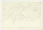
[Page] 12 -- Sheet 71 Plan 2 Trace 5 -- Colmonell ParishTranscribers who have contributed to this page.
Chr1smac -Moderator, macfam
Location information for this page.
Linked mapsheets.