OS1/3/13/87


| List of names as written | Various modes of spelling | Authorities for spelling | Situation | Description remarks |
|---|---|---|---|---|
| KNOCKDHU BURN | Knockdhu Burn Knockdhu Burn Knockdhu Burn Knockdhu Burn KnockdowBurn Knockdhu Burn |
Thomas McKeown Rev. [Reverend] John Milroy James McIlraith Esq. Robert Temple William Dill |
066 | [Situation] On the S.W. [South West] Corner of the Plan at the North base of Knockddhu Hill A Small Stream which takes its rise from Surface water on the S.W. [South West] Side of Foird Hill & runs into the River Stinchar, Near old Kirkcudbright, dividing Craigneil Hill from Knockdhu Hill in its Course. |
| CRAIGNEIL HILL | Craigneil Hill Craigneil Hill Craigneil Hill Craigneil Hill Craigniel Hill Craigneil Hill Craigneil Hill Craigneil Hill |
Mr Thomas McKeown Rev. [Reverend] John Milroy James Mcllraith Esqr. Mr Robert Temple John Jamieson William Dill Alexander Cathcart Esqr. Statistical Account 1842 |
066 | [Situation] On the west Side of the Plan about 1 Mile South of Colmonell. A Middling Sized hill, partly arable & partly heathy, Its North Side, facing the Village of Colmonell is Steep but the other Sides fall off gently. It Commands a view of the whole Valley of Stinchar from Penmore to Knockdolian [Signyfying the name Rock] |
Continued entries/extra info
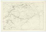
[Page] 87-- Plan 7 -- Trace No. 1 -- Parish of ColmonellTranscriber's notes
Should be Plan 66Transcribers who have contributed to this page.
Chr1smac -Moderator
Location information for this page.
Linked mapsheets.