OS1/3/10/97


| List of names as written | Various modes of spelling | Authorities for spelling | Situation | Description remarks |
|---|---|---|---|---|
| DRUMATOO | Drumatoo Drumatoo Drumatoo |
Revd. [Reverend] William Dill J. McIlraith Esqr William McCulloch |
067 | [Situation] In the N.E. [North East] of Plan.- A low long narrow heathy pasture hill which affords good pasture for both Sheep and Cattle in the Summer Season there is a trig [trigonometrical.] Station on the highest point of it the property of Hugh Hamilton Esqr. Penmore Girvan |
| ROUGHLEA BURN | Roughlea Burn Roughlea Burn Roughlea Burn |
Revd [Reverend] William Dill J. McIlraith Esqr. William McCulloch |
067 | Flows alternatively S.W. [South West & S.E. [South East] through N.E. [North East] of plan and joins Cammock Burn at the E [East] boundary of Roughlea Rig. A Stream flowing from the east base of Eldrick in a Southerly direction by Drumatoo it joins the junction of the Cammock and Half Merk Burns at the east base of Roughlea Rig from which it gets its name. - |
Continued entries/extra info
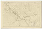
[page] 97Sheet 67 Plan 7-- Trace No. 4 & 6 -- Parish of Barr
[Signed] Thomas O' Farrell ca [civilian assistant]
4th September 54
Transcribers who have contributed to this page.
Chr1smac -Moderator, MarionQuinn
Location information for this page.
Linked mapsheets.