OS1/3/9/39


| List of names as written | Various modes of spelling | Authorities for spelling | Situation | Description remarks |
|---|---|---|---|---|
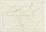
| PILNYARK BURN | Pilnyark Burn Pilnyark Burn Pilnyark Burn Poulnark Burn |
Rev. [Reverend] E. B. Wallace Rev. [Reverend] J. Gibson D McKie Esq. Johnstons Co. [County] Map |
057 | [Situation] Flows in a South Southewsterly direction, from North to South of the plan.- A broad but not rapid stream which takes its rise near the N. [North] side of the Rig of the Shalloch, and joins the Water of Minnoch near Waterhead |
| CAERLOCH DHU | Caerloch Dhu Caerloch Dhu Caerloch Dhu |
Rev. [Reverend] E. B. Wallace Rev. [Reverend] J Gibson D McKie Esq. |
057 | [Situation] Extends along the East of the plan. - A large hill running nearly N [North] & S. [South] property of the Marquis of Ailsa |
| SHALLOCH ON MINNOCH | Shalloch on Minnoch Shalloch on Minnoch Shalloch on Minnoch Shalloch on Minnock |
Rev. [Reverend] E. B. Wallace Rev. [Reverend] J Gibson D McKie Esq. Johnstons County Map |
057 ; 063 | [Situation] In the South East corner of plan. - A well-known hill situated on the E. [East] bank of the Water of Minnoch, reaching a greater elevation than any in the county. The ascent from the Minnoch presents a gradual unbroken surface, on the E. [East] side craggy & abrupt. property of the Marquis of Ailsa |
Continued entries/extra info
[Page] 39 -- Sheet 57 - - plan 16 -- Traces 1-2-3-4-6 -- Ph. [Parish] of BarrTranscribers who have contributed to this page.
Chr1smac -Moderator, MarionQuinn
Location information for this page.