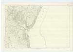
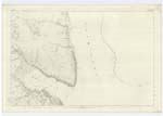
OS1/2/80/134
| List of names as written | Various modes of spelling | Authorities for spelling | Situation | Description remarks |
|---|---|---|---|---|
| LOCH LONG | Loch Long | Fullarton's Gazetteer New Stat [Statistical] Account County Map |
135; 142; 143; 153; 164; 174 | Fullartons Gazetteer "A belt of marine water, a long northward ramification of the firth of Clyde, extending between the district of Cowal in Argyllshire, and the parishes of Roseneath, Row, and Arrochar in Dumbartonshire. Over the whole of its length, it prevailingly looks almost right along all the lower parts of the Firth; and if it were but the inlet of a considerable river, would, as to both extent and direction, possess far the highest chain to be regarded as the upper Firth. It opens from the Clyde nearly opposite Gourock, and with a breadth of from 2 miles to 6 furlongs, stretches away about 22 miles into the interior. At quarter distance from its entrance it opens, on the West side, into the fine small bay of Ardentinny; and, at half-distance, it sends off, on the same side, and in a North-Westerly direction, Loch Goil: which [seen]. At two points on the Dumbartonshire side, it is distant respectively from the head of Gair-loch only 1¼ mile, and from Tarbet on Loch Lomond only 1¾ mile. Its general depth is from 15 to 20 fathoms, and its tidal current runs at the rate of about 2 miles in the hour. It is occasionally lined by a sandy beach, or pressed by hanging plants and boughs of Verdure, but in general is hemmed in by declivitous or mural rocks. Seen from the entrance or from ground on the opposite of the firth which commands a view of it, it presumes for some distance on the East a beautiful softness of feature which is almost lowland." |
Continued entries/extra info
[Page] 134Parish of Kilmun -- County of Argyll
Transcribers who have contributed to this page.
Celia Skelton
Location information for this page.
Linked mapsheets.


