OS1/2/78/144


| List of names as written | Various modes of spelling | Authorities for spelling | Situation | Description remarks |
|---|---|---|---|---|
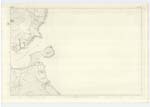
| MACRINGAN'S POINT | Macringan's Point Macringan's Point Macringan's Point Macringan's Point Macrinnan Point |
Estate Map in possession of Stewart Esqr. Chamberlain to the Duke of Argyll Peter McIntosh Dalintober Admiralty Chart |
258 | A prominent & rocky point of land jutting into Kilbranan Sound at miuth of Campbeltown Loch. |
| BARASCOMILL BURN | Baraskomill Burn Baraskomill Burn Baraskomill Burn |
Mr. Ferguson, Managing Clek to Stewart Esqr. Map appended to "Reports upon the Boundaries of the several Cities, Burghs & towns of Scotland &c", P McIntosh |
258 | A small stream rising about 3/4 of a mile north of the farmhouse of High Askomill, flows in a southerly direction partly through a small wooded glen. Forms part of the Parlimentarey Boundary, and falls into Campbeltown Loch. |
| HIGH ASKOMILL | High Askomill High Askomill High Askomill |
Mr. Ferguson P McIntish Map appended &c &c [to "Reports upon the Boundaries of the several Cities, Burghs & towns of Scotland &c"] |
258 | A small farm-steading. The property of Campbell Davies Esqr. |
Continued entries/extra info
[Page] 144Parish of Campbeltown
Transcribers who have contributed to this page.
hillhere
Location information for this page.
Linked mapsheets.