OS1/2/53/4


| List of names as written | Various modes of spelling | Authorities for spelling | Situation | Description remarks |
|---|---|---|---|---|
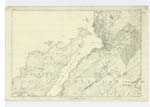
| ARDANTRIVE | Ardantrive Ardantrive Ardintrive |
[name missing] Ardantrive L. McLachlan Ferryman County Map. |
098 | A large farmhouse and extensive offices attached about a mile from the north end of Kerrera. The property of The Earl of Breadalbane. |
| ARDANTRIVE BAY | Ardantrive Bay Ardantrive Bay Ardantrive Bay Ardintrive Bay |
A McDougall Slatrach L. McLachlan, Ferryman Admiralty Chart. |
098 | A good sized bay on the east side of the Island of Kerrera a short distance north of the farm of Ardantrive |
| RUDH' A' BHEARNAIG | Ru Bhairneach Rudh' a' Bhearnaig Rudh' a' Bhearnaig |
Admiralty chart L. McLachlan. Ferryman. Allan McDougall. Slatrach. |
098 | The most northerly point of the island of Kerrera. about a mile from "Ardantrive". Sig [Signification]: uncertain. |
| RUDH' A' CHRUIDH | Rudh' a' Chruidh Rudh' a' Chruidh |
D. McFarlane Duncan Clark_ Oban. |
098 | A pt. [point] of land situated north of Ardintrive Bay. Sig [Signification]:- "The Castle point." |
Continued entries/extra info
[Page] 4Transcriber's notes
Suspect that the missing name in the authority of "Ardantrive" might be A. McDougall Slatrach (see Ardantrive Bay below it).Transcribers who have contributed to this page.
ron hill
Location information for this page.
Linked mapsheets.