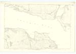
OS1/2/46/1/42
| List of names as written | Various modes of spelling | Authorities for spelling | Situation | Description remarks |
|---|---|---|---|---|
| ALLT AIRIDH NAN STANG | Allt Airidh nan Stang Allt Airidh nan Stang Allt Airidh nan Stang |
Dugald McPhail Tenant Fishnish Mr McInnes Farmer Ballynachendy Revd [Reverend] John Day Minister of Salen |
070 | Applies to a mountain stream rising a short distance S. [South] of A' Bhuigneach, it flows N.E [North East] till it gets to Feith Bhàn when it turns S.E [South East] & flows to its confluence with Garmony Burn, at the South E [East] end of Feith Bhàn. Sig. [Signification] "Stream of the Shealing of the ditches' |
| FÉITH BHÀN | Féith Bhàn | Dugald McPhail Tenant Fishnish Mr McInnes Farmer Ballynachendy Revd [Reverend] John Day Minister of Salen |
070 | Applies to a mossy flat, through which, Allt Airidh an Staing flows, it is about 1/4 of a mile South of Druim Buidhe. Sig. [Signification] "White Marsh" |
| ACHADH NA H-UAMHA | Achadh na h-Uamha | Dugald McPhail Tenant Fishnish Mr McInnes Farmer Ballynachendy Revd [Reverend] John Day Minister of Salen |
070 | Applies to a field near the sea shore and on the N. [North] side of Garmony burn about 1/4 of a mile E [East] of Garmony Farm. Sig. [Signification] "Field of the Cave" |
Continued entries/extra info
[page] 42Sheet 70 Plan 15 -- Isle of Mull -- County of Argyll
Achadh na h-Uamha [marginal]
[signed] T Gilloley
Transcribers who have contributed to this page.
Rainey R, Bizzy- Moderator, Bert, Margaret Ferguson Burns
Location information for this page.
Linked mapsheets.


