OS1/2/46/1/13


| List of names as written | Various modes of spelling | Authorities for spelling | Situation | Description remarks |
|---|---|---|---|---|
| ALLT DRUIM A' MHUILINN | Allt Druim a' Mhuilinn Allt Druim a' Mhuilinn Allt Druim a' Mhuilinn |
Duncan Cleark Callachilly Mr McPhail farmer, Callachilly Revd [Reverend] John Day Minister of Salen |
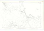
069 | Applies to a small mountain stream rising on the east-side of Druin a' Mhuiluin & flowing in a north westerly direction to River Forsa a short distance north from Pennygown Sig [Signifies] "Stream of the Mill." |
| ALLT NA FAING BIGE | Allnt na Fiang Bige | Duncan Cleark Callachilly Mr McPhail farmer, Callachilly Revd [Reverend] John Day Minister of Salen |
069 | Applies to a mountain stream rises a short distance east of Druinn a Mhuiluin and flows in a north westerly direction parallel with Allt Druim a Mhuilin till it empties itself into the north end of River Forsa. Sig [Signifies] "Stream of the little field". |
| EAS DUBH | Eas Dubh | Duncan Cleark Callachilly Mr McPhail farmer, Callachilly Revd [Reverend] John Day Minister of Salen |
069 | Applies to a mountain stream rising about ½ mile south west of Callachilly & flowing in a North easterly direction to the main road from Salen to Grass Point where it changes its name to Abhuinn Cuil Mhurchaidh. Sig [Signifies] "Black Waterfall". |
Continued entries/extra info
[Page] 13Sheet 69 Plan 12 -- Isle of Mull -- County of Argyll
[signed] R. HawKins R.E. [Royal Engineers]
Transcribers who have contributed to this page.
Bizzy- Moderator, Dicadge
Location information for this page.
Linked mapsheets.