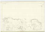
OS1/2/37/51
| List of names as written | Various modes of spelling | Authorities for spelling | Situation | Description remarks |
|---|---|---|---|---|
| BLÀR DUBH | Blàr Dubh Blàr Dubh Blàr Dubh |
John McGregor Camas Tuath Rev. [Reverend] A. Campbell, Bunessan Duncan McKenzie, teacher, Bunessan |
105 | A tract of pasture land lying between Achadh na Ceàrdaich and Achadh Rusgte. Sig: [Signification] Black plain. |
| ACHADH NA CEÀRDAICH | Achadh na Ceàrdaich | John McGregor Camas Tuath Rev. [Reverend] A. Campbell, Bunessan Duncan McKenzie, teacher, Bunessan |
105 | A small piece of pasture land on the east side of Blàr Dubh and south east of Feith Ruadh. Sig: [Signification] Field of the Smithy |
| SALANN SALACH | Salann Salach | John McGregor Camas Tuath Rev. [Reverend] A. Campbell, Bunessan Duncan McKenzie, teacher, Bunessan |
105 | A piece of marshy land south of Cnoc a' Chamais and east of Cnoc Deuchainneach. Sig: [Signification] Dirty Salt. |
| CAMAS TUATH | Camas Tuath | John McGregor Camas Tuath Rev. [Reverend] A. Campbell, Bunessan Duncan McKenzie, teacher, Bunessan |
105 | A bay near the entrance to the Sound of Iona and 1/2 a mile north east of Ardfenaig house, having a pier for the accommodation of the granite quarries in the neighbourhood. Sig: [Signification] North Bay. |
Continued entries/extra info
[Page] 51Sheet 105 Plan 14. -- Island of Mull -- County of Argyll.
Camas Tuath [note]
(Marginal)
[Page signed]
T. McLean
Sapper R.E. [Royal Engineers]
Transcribers who have contributed to this page.
Alison James- Moderator, hillhere
Location information for this page.
Linked mapsheets.


