OS1/2/22/125


| List of names as written | Various modes of spelling | Authorities for spelling | Situation | Description remarks |
|---|---|---|---|---|
| RUDHA CLACH THOLL | Rudha Clach Tholl Rudha Clach Tholl Rudha Clach Tholl Ru nan Clach toll |
R. McFie Esq of Airds Mr. Stewart Appin D. McNiven Woodhall Admiralty Chart |
073 | A conspicuous promontory about a mile south of Port Appin. Sig [Signification] "Point of the perforated stone" or Rock |
| CLACH THOLL | Clach Tholl Clach Tholl Clach Tholl |
R. McFie, Esq Mr. Stewart Appin D. McNiven Woodhall |
073 | A large opening in the rock near the extreme end of the above point, and from which the point takes its name. Sig. [Signification] "The Perforated Rock". |
| AIRDS BAY | Airds Bay Airds Bay Airds Bay Airds Bay |
R. McFie, Esq Mr. Stewart Appin D. McNiven Woodhall Admiralty Chart |
073 | A large bay extending from near Airds House southwards for nearly 1/2 a mile. |
| CÀM PHORT | Càm Phort Càm Phort Càm Phort |
Estate Plan Captain Carmichael Airds D. McNiven Woodhall: |
073 | A small creek on east side of Airds Bay, about 1/2 a mile south of Airds House. Sign. [Signification] "Crooked Port". |
| APPIN ROCKS | Appin Rocks Appin Rocks Appin Rocks Appin Rocks |
Admiralty Chart D. McNiven Woodhall A. McColl Lismore Admiralty Chart |
073 | Applicable to two small reefs at south west end of Rudha Clach Tholl. |
Continued entries/extra info
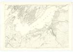
[Page] 125Sheet 73.1 -- Parish of Appin -- Argyllshire
Transcribers who have contributed to this page.
Alison James- Moderator, Miss Lomond
Location information for this page.
Linked mapsheets.