OS1/1/57/1


| List of names as written | Various modes of spelling | Authorities for spelling | Situation | Description remarks |
|---|---|---|---|---|
| LONGSIDE [parish] | Longside Longside Longside Longside |
Statistical Account, Aberdeenshire Valuation Roll of the Parish Johnston's Map of the County The Imperial Gazetteer of Scotland |
014 ; 022 ; 023 ; 031 ; 032 | "Longside. This parish was disjoined from Peterhead about two hundred and twenty years ago. For a considerable period, the Presbytery appointed Several of its members, with some elders of Peterhead, to "travell with my Lord Merschell," who was at that time chief proprietor of the district, to have " ane new Kyrk bouldit in the head," or west part, "of the paroche." This was at last effected in A.D. 1619 or 1620, and the church was for some time termed "the ower (ie. upper) kirk of Peterugie," or "Peterheid". The parish, however, was soon after called "Longsyd" from the name of the farm on which the church was situated. It is of an irregular, four-sided figure, containing about 30 Square miles; and is bounded on the east by St. Fergus and Peterhead; on the south by Cruden; on the west and north-west by Old Deer; and on the north by Lonmay. Like Buchan in general, it is very level, or rising into gentle undulations which afford facilities for draining the land." "Statistical Account of Scotland." pages 859 & 60 Note. There are no detached parts of this within any other Parish, nor are there any others within this. |
Continued entries/extra info
[Page] 1County of Aberdeenshire -- Longside Parish
Transcribers who have contributed to this page.
CorrieBuidhe- Moderator, Kate51- Moderator
Location information for this page.
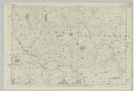
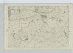
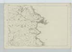
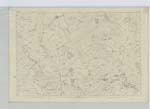
Linked mapsheets.