OS1/35/73/25


| List of names as written | Various modes of spelling | Authorities for spelling | Situation | Description remarks |
|---|---|---|---|---|
| GLENTRIPLOCK | Glentriplock Glentriplock North & South . Glentriplock Glentripplock . . Glentriplock |
John Anderson Mathew Gilespie Ainslies Map of 1782 Rl. Engrs. [Royal Engineers] Map 1819. George McHaffie Esqr. |
029 | [Situation] About 1/2 mile E by N [East by North] of Kirk of Mochrum. farm houses and out houses all in good repair with a farm of land attached to each, this land was formerly one farm but is now divided into two & are respectively occupied by Mathew Gilespie and John Anderson. The property of Sir William Maxwell. |
| WHORRIE BURN | Whorrie Burn Whorrie Burn Whorrie Burn |
John Anderson John Gray George McHaffie Esqr. |
029 | [Situation] Near the SE [South East] Side of Drumneil. The continuation of Skate Burn, retaining Whorrie Burn from its entry unto the Said farm to the adjoining one called Glentriplock. - |
Continued entries/extra info
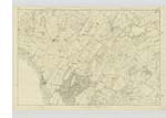
[Page] 25 -- Parish of Mochrum -- 1st page of Trace 6 - 29 ATranscribers who have contributed to this page.
Chr1smac -Moderator, Muriel Rousay
Location information for this page.
Linked mapsheets.