OS1/35/2/35


| List of names as written | Various modes of spelling | Authorities for spelling | Situation | Description remarks |
|---|---|---|---|---|
| PORTLONG BAY | Portlong Bay Portlong Bay Port Long Port Long Portlong Bay |
James Kennedy Archibald Niblo Ainslie's Map 1782 Rl. Engrs [Royal Engineers] Map 1819 George McHaffie Esqr. |
004 | [Situation] About ¾ mile south of Port Garvillan An opening or cleft between rocks near Laggan Kiln Though the name is tolerably well Known yet is an object of little note |
| LAGGAN HILL | Laggan Kiln Laggan Kiln Laggan Hill Laggan Hill Laggan Hill Laggan Hill |
James Kennedy Archibald Niblo Alexander McNeil Esqr. Andrew McWilliam Henry McClymont Mrs Wallace |
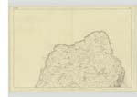
004 | [Situation] On the East side of Portlong Bay A hill of a ridge like shape on which stood formerly a corn Kiln the site of which can only with difficulty be traced but some rubbish or ruins of it remains on which is a Trigl. [Trigonometrical] Station called by Trigl. [Trigonometrical] Party "Laggan Hill" on the shore near this place is a dangerous reef of rocks called the Sea of Laggan or The Ebb Stone See adjoining plan |
| WHITE HILL | White Hill White Hill White Hill |
James Kennedy Archibald Niblo George McHaffie Esqr. |
004 | [Situation] adjoining the north Side of Laggan Hill A Small hill on the farm of South Cairn the soil of which is arable the nearest the sea is precipitous forming a ridge or bank apparently caused by the action of water at some remote period |
Continued entries/extra info
[Page] 35Parish of Kirkcolm
Transcribers who have contributed to this page.
Chr1smac -Moderator, Missus SW
Location information for this page.
Linked mapsheets.