System Outage
We are migrating the servers that support this website to a new platform. Service will be affected for some time. Further information is available here.
OS1/10/20/130


| List of names as written | Various modes of spelling | Authorities for spelling | Situation | Description remarks |
|---|---|---|---|---|
| KAPLESTON HILL | Kapleston Hill | John Ogilvie Farmer Cooms Simon Rutherford Shepherd Lodgegill |
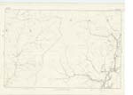
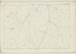
037 | [Situation] At the East point of this Parish. A large hill on the farm of Lodgegill; the surface of which is heathy pasture & rocks. It is situated between Kapleston Syke, and Tarras Water. |
| RONE FELL | Rone Fell Rone Fell Rone Fell |
R. Anderson, Wrae J. Common, Meikledale Johnston's County Map. |
036 | A large hill on the boundary between Dumfries And Roxburgh Shires the highest point of which is Millstone Edge in the latter County. |
Continued entries/extra info
[Page] 130Parish of Ewes -- Sheet 37 -- No. 6 -- Trace 3
Millstone Edge [crossed out]
[Signed] P. McHugh
Lce. Cor RE [Lance Corporal Royal Engineers]
Transcribers who have contributed to this page.
CorrieBuidhe- Moderator, gengirl44
Location information for this page.