OS1/10/20/129


| List of names as written | Various modes of spelling | Authorities for spelling | Situation | Description remarks |
|---|---|---|---|---|
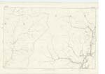
| KAPLESTON SIKE | Kapleston Syke | John Ogilvie Farmer Cooms Simon Rutherford Shepherd Lodgegill |
037 | [Situation] From East to west side of Kapleston Hill. A large stream having its source from surface water at Millstone Edge, flowing from that in a westerly direction falls into Tarras Water, about 14 chains below Deepdale Syke. |
| HOWGILL HILL | Howgill Hill | John Ogilvie Farmer Cooms Simon Rutherford Shepherd Lodgegill |
037 | [Situation] At the East point of this Parish. A small hill the surface of which is heathy pasture, on the farm of Lodgegill, and situated between Howegill Syke, & Kapleston Syke. |
| TARRAS WATER | Tarras Water | Described on Sheet 37. No. 5 | ||
| DEEPDALE SIKE | Deepdale Sike | See Name Sheet for Plan 37. 2 | ||
| MID HEIGHT | Mid Height | See Name Sheet for Plan 37. 8. |
Continued entries/extra info
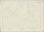
[Page] 129Parish of Ewes -- Sheet 37 -- No. 6 -- Trace 1
Howgill Hill [note] How - a hollow. Dr. [Doctor] Jamieson's Dictionary
[Signed] P. McHugh
Lce. Cor RE [Lance Corporal Royal Engineers]
Transcribers who have contributed to this page.
CorrieBuidhe- Moderator, gengirl44
Location information for this page.