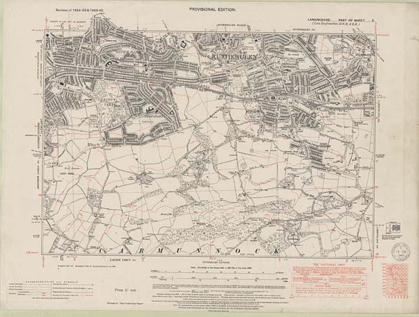
Ordnance Survey Six-inch To The Mile, Lanarkshire Sheet X.centre

See: <a href="https://maps.nls.uk/os/6inch-2nd-and-later/">Ordnance Survey Maps Six-inch 2nd and later editions, 1892-1960</a>
This image and its related metadata are available under a Creative Commons Attribution-NonCommercial-ShareAlike 4.0 International License. Under this license you are free to share and adapt material, as long as you provide a credit to the source and a link to the license, do not use the material for commercial purposes, and use the same license if you share any re-mixes or transformations you make of the material.

Details

Organisation: National Library of Scotland (NLS)

Reference number: 75650799

Parishes: Cambuslang, Carmunnock, Cathcart, Rutherglen

Counties: Lanarkshire

Date of survey: 1940

Survey date: 1940

Publication date: ca. 1949

Centroid: Easting/Northing: 261007, 659677.5

Notes: See: Ordnance Survey Maps Six-inch 2nd and later editions, 1892-1960