
Village, Houses 3,4 and 5.
View from East along street.
View in Canmore
View in Canmore

Village.
General view from South West.
View in Canmore
View in Canmore

Village Bay, consumption dyke and cleits. View from SE, including cleits 91 and 92.
View in Canmore
View in Canmore

Village Bay, Abhainn Ilishgil. View of the 'Dry Burn' from NNE, with the Ministry of Defence office block, garages and stores in the background.
View in Canmore
View in Canmore

Hirta, Village Bay. General view from N, including the Ministry of Defence Establishment, with Dun beyond.
View in Canmore
View in Canmore

Hirta, Village Bay. General view along the Street from NW, including the burial ground, Factor's House, ablutions block and water tanks.
View in Canmore
View in Canmore

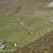
Hirta, Village Bay. General view from SE showing the Street, crofts and head dyke, and including the Ministry of Defence Establishment.
View in Canmore
View in Canmore

Hirta, Village Bay. General view from SE showing the Street, crofts and head dyke, with the quarry on Mullach Geal beyond.
View in Canmore
View in Canmore

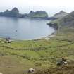
Hirta, Village Bay. General view from N, including the Ministry of Defence Establishment, with Dun beyond.
View in Canmore
View in Canmore

Hirta, Village Bay. General view from W including the Ministry of Defence Establishment.
View in Canmore
View in Canmore

Hirta, Village Bay. View from SE along the Street showing houses 1-8.
View in Canmore
View in Canmore

Hirta, Village Bay. View from SE along the Street showing houses 4-7.
View in Canmore
View in Canmore

St Kilda, Hirta. RCAHMS GPS survey base station in Village Bay.
View in Canmore
View in Canmore

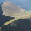
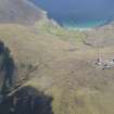
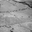
General oblique aerial view of St Kilda, centred on Village Bay, taken from the ESE.
View in Canmore
View in Canmore

General oblique aerial view of St Kilda, centred on Village Bay, taken from the E.
View in Canmore
View in Canmore

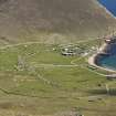
General oblique aerial view of St Kilda, centred on Village Bay and enclosures at An Lag Bho'n Tuath, taken from the NW.
View in Canmore
View in Canmore

General oblique aerial view of St Kilda, centred on Mullach Mor Radar Station, taken from the NNW.
View in Canmore
View in Canmore

Village.
General view of area around cleit 121 showing Head Dyke.
View in Canmore
View in Canmore

Village.
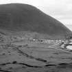
General view of village along the street from East.
View in Canmore
View in Canmore

Village, Houses 12,13,14,15,16.
View from North East along street.
View in Canmore
View in Canmore

Village.
General view from West towards Oiseval including Ministry of Defence Establishment.
View in Canmore
View in Canmore

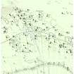
St Kilda, Village Bay. Plane-table survey, sheet 3.
View in Canmore
View in Canmore

St Kilda, Village Bay. Plane-table survey, sheet 6.
View in Canmore
View in Canmore

St Kilda, Village Bay. Plane-table survey, sheet 10.
View in Canmore
View in Canmore

St Kilda Village. General view to the west with the gable of Blackhouse E in the foreground.
View in Canmore
View in Canmore

St Kilda, Village Bay. General view of the area of the crofts behind Houses 12-16 showing cultivation remains, cleitean, turf-cutting etc.
View in Canmore
View in Canmore

St Kilda, Village Bay. General view of the west end of the village (Houses 12-13) from above the head dyke, with cleit 61 in the foreground (right).
View in Canmore
View in Canmore

St Kilda, Village Bay. General view looking west with cleit 32 in the foreground.
View in Canmore
View in Canmore

St Kilda Village.
Photographic copy of ink sketch showing view from South.
Titled: 'St Kilda from the South'.
Ink, paper. Copied from Logie, DW 1889.
View in Canmore
View in Canmore

St Kilda, Village Bay. General view of the north east area. with the burial ground in the foreground and the head dyke in the background.
View in Canmore
View in Canmore

St Kilda, Village Bay. General view facing south east.
View in Canmore
View in Canmore

View of Mullach Sgar from the military base, St Kilda.
View in Canmore
View in Canmore

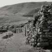
19th-century houses and blackhouses on the village street.
View in Canmore
View in Canmore

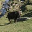
A Soay sheep in the village.
View in Canmore
View in Canmore

A cleit in the village.
View in Canmore
View in Canmore

Publication Illustration, St Kilda, Tobar Childa field system. 400dpi copy of GV005719.
View in Canmore
View in Canmore

Ian Parker GPS plotting Cleit 1073 and Enclosure 2110
View in Canmore
View in Canmore

Cleit 157
View in Canmore
View in Canmore

Cleit 167
View in Canmore
View in Canmore

Cleit 34 with hoe blade fragment
View in Canmore
View in Canmore

Cleit 35 with stone pounder
View in Canmore
View in Canmore

Cleit 35 with stone pounder
View in Canmore
View in Canmore

Cleit 35 with stone pounder
View in Canmore
View in Canmore

Cleit 38, showing revetment and terrace
View in Canmore
View in Canmore

Cleit 52, downslope end
View in Canmore
View in Canmore

Cleit 107 with revetment to burn
View in Canmore
View in Canmore

Cleit 66, stones on turf cap
View in Canmore
View in Canmore

Cleit 70, cell on SW
View in Canmore
View in Canmore

Cleit 75
View in Canmore
View in Canmore

Cleit 76 on mound
View in Canmore
View in Canmore

Cleit 76, hoe blade fragment
View in Canmore
View in Canmore

Cleit 85, Lady Grange's House, hoe blade fragment
View in Canmore
View in Canmore

Cleit 90
View in Canmore
View in Canmore

Cleit 94, blocked fanlight
View in Canmore
View in Canmore

Cleit 94, hoe blade fragment
View in Canmore
View in Canmore

Head dyke crossing burn
View in Canmore
View in Canmore

Soay sheep
View in Canmore
View in Canmore

Cleit 96
View in Canmore
View in Canmore

Cleit 2215
View in Canmore
View in Canmore

Enclosure 16
View in Canmore
View in Canmore

Enclosure 32
View in Canmore
View in Canmore

Enclosure 33, entrance
View in Canmore
View in Canmore

Enclosure 39, inner wall
View in Canmore
View in Canmore

Cleit 76, hoe blade fragment from above lintel
View in Canmore
View in Canmore

Cleit 76, hoe blade fragment from above lintel
View in Canmore
View in Canmore

View of the saw pit
View in Canmore
View in Canmore

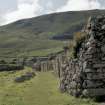
Medieval (?) head dyke
View in Canmore
View in Canmore

Interior of Lady Grange's cleit, cleit 85
View in Canmore
View in Canmore

Village.
General view from Point of Coll.
View in Canmore
View in Canmore

Village.
General view from Point of Coll.
View in Canmore
View in Canmore

Village, Houses 1,2,3,4,5.
General view from North West.
View in Canmore
View in Canmore

Village, Houses 6,7,8,9,10.
View from East along street.
View in Canmore
View in Canmore

Village.
General view from East.
View in Canmore
View in Canmore

Village.
General view from West towards Oiseval.
View in Canmore
View in Canmore

Village.
General view from West towards Oiseval including Ministry of Defence Establishment.
View in Canmore
View in Canmore

Village.
General view from West towards An Lag Bho'n Tuath and Oiseval.
View in Canmore
View in Canmore

Village.
General view from West towards An Lag Bho'n Tuath and Oiseval.
View in Canmore
View in Canmore

St Kilda. View of cleit in Village Bay.
View in Canmore
View in Canmore

Village.
General view of Ministry of Defence Establishment from North West.
View in Canmore
View in Canmore

Village.
General view from West including Burial Ground.
View in Canmore
View in Canmore

St Kilda Village.
General view from North West towards bay with steamer at anchor, including Store, School, Church and Manse in distance.
View in Canmore
View in Canmore

Hirta, Village Bay. General view from NE, including the radar station on Mullach Sgar, Ruaival and Dun.
View in Canmore
View in Canmore

Hirta, Village Bay. General view from N, including the Ministry of Defence Establishment, with Dun beyond.
View in Canmore
View in Canmore

Hirta, Village Bay. General view from N with Dun beyond.
View in Canmore
View in Canmore

Hirta, Village Bay. View from E showing crofts and cleits.
View in Canmore
View in Canmore

Hirta, Village Bay. General view from SW.
View in Canmore
View in Canmore

Hirta, Village Bay. General view from SW.
View in Canmore
View in Canmore

Hirta, Village Bay. View from SW, including houses 11-14 and blackhouses P-S.
View in Canmore
View in Canmore

Hirta, Village Bay. View from SE, including houses 14-16 and blackhouses S-T.
View in Canmore
View in Canmore

Hirta, Village Bay. General view from W including the Ministry of Defence Establishment.
View in Canmore
View in Canmore

Hirta, Village Bay. View from SE along the Street showing houses 2-7.
View in Canmore
View in Canmore

Hirta, Village Bay. View from SE along the Street showing houses 5-8.
View in Canmore
View in Canmore

Hirta, Village Bay. View from SW along the Street showing houses 11-15 and blackhouse S.
View in Canmore
View in Canmore

Hirta, Village Bay. View from S of blackhouse R and cleits 78-9.
View in Canmore
View in Canmore

Hirta, Village Bay. View of house 1 from SE.
View in Canmore
View in Canmore

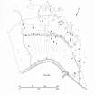
Publication drawing; St Kilda, Village: distribution plan of buildings built or remodelled since 1886.
View in Canmore
View in Canmore

General oblique aerial view of St Kilda, centred on the islands of Hirta and Dun, taken from the SW.
View in Canmore
View in Canmore

General oblique aerial view looking over the saddle towards Village Bay, taken from the NE.
View in Canmore
View in Canmore

General oblique aerial view of St Kilda, centred on Village Bay, taken from the SSE.
View in Canmore
View in Canmore

Village.
General view from East including Burial Ground.
View in Canmore
View in Canmore




























You may copy, display, store and make derivative works for personal use or use solely within an educational institution by staff and students, under these conditions: the ScotlandsPlaces website is attributed, there is no commercial use or sale, and no public distribution (for example, by hand, email, or web). Full licence details.
Details
Organisation: Historic Environment Scotland (HES)
Alternative name(s): St Kilda Village And Related Structures
Canmore ID: 9668
Site type: Cleit(s) (19th Century) - (20th Century), Consumption Dyke(s) (19th Century), Village (19th Century) - (20th Century)
County: Inverness-shire
Parish: Harris
Council: Western Isles


