
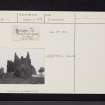
Gilbertfield Castle


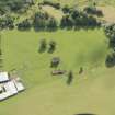
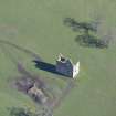
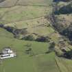
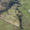
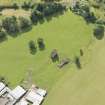
Oblique aerial view of Gilbertfield Castle, looking ESE.
View in Canmore
View in Canmore

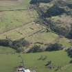
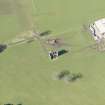
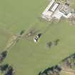
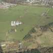
Oblique aerial view of part of the Dechmont Rifle Ranges and Gilbertfield Castle, looking ESE.
View in Canmore
View in Canmore

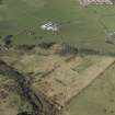
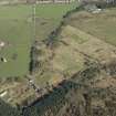
Oblique aerial view of part of the Dechmont Rifle Ranges and Gilbertfield Castle, looking WNW.
View in Canmore
View in Canmore

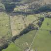
Oblique aerial view of part of the Dechmont Rifle Ranges and Gilbertfield Castle, looking SSE.
View in Canmore
View in Canmore

Oblique aerial view of Gilbertfield Castle, looking NE.
View in Canmore
View in Canmore

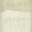
Drawing of south, north, east and west elevations, Gilbertfield Castle
View in Canmore
View in Canmore

Gilbertfield House.
View in Canmore
View in Canmore

Oblique aerial view of Gilbertfield Castle, looking W.
View in Canmore
View in Canmore

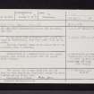
Gilbertfield Castle, NS65NE 12, Ordnance Survey index card, Recto
View in Canmore
View in Canmore

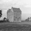
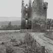
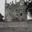
Gilbertfield House.
General view from North.
View in Canmore
View in Canmore

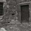
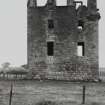
Gilbertfield House.
View of North-East entrance.
View in Canmore
View in Canmore

Oblique aerial view of part of the Dechmont Rifle Ranges and Gilbertfield Castle, looking E.
View in Canmore
View in Canmore

Oblique aerial view of part of the Dechmont Rifle Ranges and Gilbertfield Castle, looking SSW.
View in Canmore
View in Canmore

Oblique aerial view of Gilbertfield Castle, looking NNW.
View in Canmore
View in Canmore

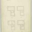
Drawing of plans of upper, second, ground and first floors, Gilbertfield Castle
View in Canmore
View in Canmore

Gilbertfield House.
Plan showing details of dormer windows, corbelling, turret window and gable.
View in Canmore
View in Canmore

Oblique aerial view of Gilbertfield Castle, looking NNW.
View in Canmore
View in Canmore

Gilbertfield Castle, NS65NE 12, Ordnance Survey index card, page number 1, Recto
View in Canmore
View in Canmore

Oblique aerial view of part of the Dechmont Rifle Ranges and Gilbertfield Castle, looking N.
View in Canmore
View in Canmore

Gilbertfield Castle, NS65NE 12, Ordnance Survey index card, Recto
View in Canmore
View in Canmore

Oblique aerial view of Gilbertfield Castle, looking SE.
View in Canmore
View in Canmore

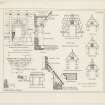
Drawing of section and details including turret, roof, windows, dormer and fireplaces, Gilbertfield Castle
View in Canmore
View in Canmore

Gilbertfield House.
General view from South.
View in Canmore
View in Canmore

Gilbertfield House.
General view from West.
View in Canmore
View in Canmore
You may copy, display, store and make derivative works for personal use or use solely within an educational institution by staff and students, under these conditions: the ScotlandsPlaces website is attributed, there is no commercial use or sale, and no public distribution (for example, by hand, email, or web). Full licence details.
Details
Organisation: Historic Environment Scotland (HES)
Alternative name(s):
Canmore ID: 44861
Site type: Castle (medieval)
County: Lanarkshire
Parish: Cambuslang (city Of Glasgow)
Council: South Lanarkshire