OS1/27/2/66


| List of names as written | Various modes of spelling | Authorities for spelling | Situation | Description remarks |
|---|---|---|---|---|
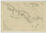
| MÀS SGEIR | Màs Sgeir | John Morrison Cnoc Ard Informant could not spell John Morrison Ordce [Ordnance] Survey |
003 | A large high water rock situated between a group of Smaller ones at the Butt of Lewis. |
| LÌTH SGEIR | Lìth Sgeir | John Morrison Cnoc Ard Informant could not spell John Morrison Ordce [Ordnance] Survey |
003 | The most northerly rock in Lewis. It is adjacent to Mas Sgeir, about three chains long, and covered at High water. |
| STATHANIS | Strathanis | John Morrison Cnoc Ard Informant could not spell John Morrison Ordce [Ordnance] Survey |
003 | The East coast of the Butt of Lewis, between Ramaga and Port Stoth, part of it is steep and perpendicular, part low and rugged. |
Continued entries/extra info
[page] 66Plan 3 A List of Names collected by 2nd Corporal Hayes
Township or Parish - Barvas
Objects
Màs Sgeir - Rock
Lìth Sgeir - Rock
Strathanis - Coast
[signed] Michael H[ayes]
2nd Corpl. R[S&M] [Corporal Royal Sappers and Miners]
22nd May [1852]
Transcribers who have contributed to this page.
Bizzy- Moderator, eilthireach
Location information for this page.